Plan the day's stops with no signal.
Load a spreadsheet of stops, get the best order to visit them, and go. Everything runs on the phone. There is no account and no server, and your spreadsheet never leaves the device.
Passed airplane-mode test in emulator · beta
The browser version is the same app. Your file is read in your browser and nothing is uploaded. Routes you save stay in this browser. Need a file to try? Download sample-stops.csv
Four steps, all on the device
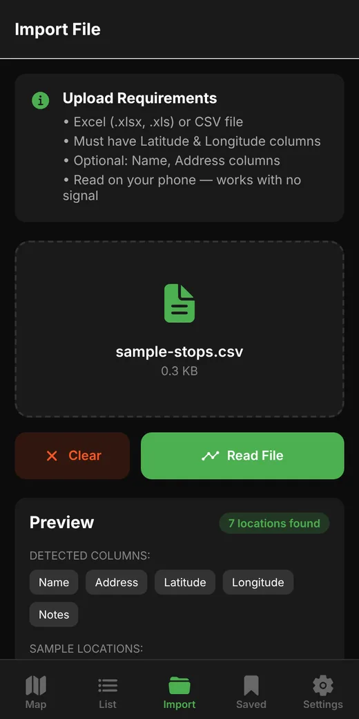
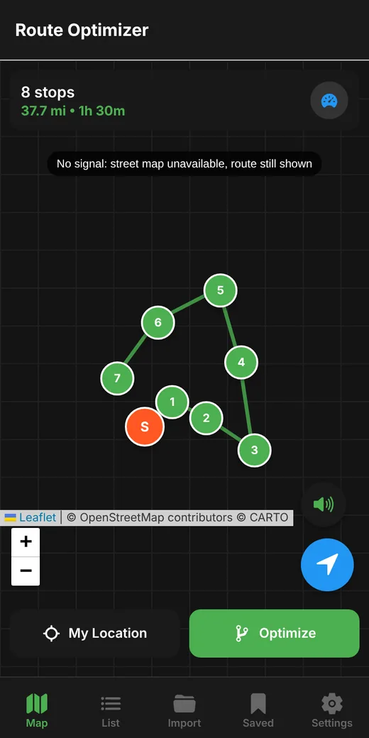
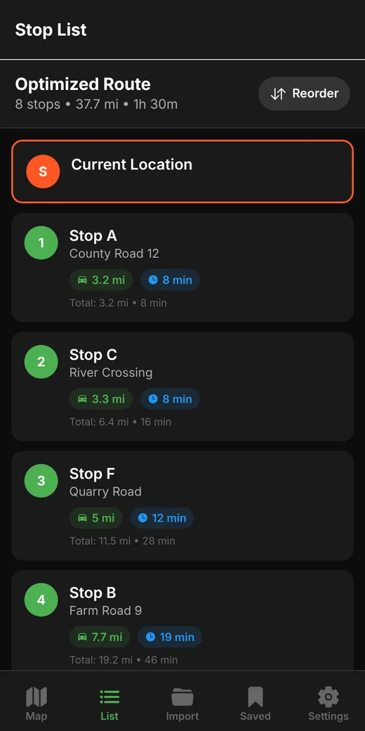
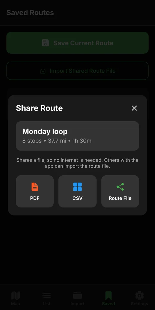
These are real screens from version 2.1.0, captured from the app's browser build with networking turned off.
What works with no signal
● Works offline● Needs a connection
| Feature | Offline | Notes |
|---|---|---|
| Import stops from CSV or Excel | ● Yes | Reads .csv, .xlsx and .xls on the phone. The file is never uploaded. |
| Optimize the route | ● Yes | Runs on the device. Distances are straight-line estimates. |
| Drag to reorder stops | ● Yes | Distance and time totals update as you go. |
| Set your start from GPS | ● Yes | GPS works without mobile data. A first fix can take a minute under open sky. |
| Fuel cost estimate | ● Yes | From your vehicle's MPG and the price per gallon. |
| Spoken stop announcements | ● Yes | Uses the phone's built-in voice. |
| Save and reload routes | ● Yes | Stored on the device only. |
| Share as PDF, CSV or route file | ● Yes | Through the share sheet: email, Bluetooth, nearby sharing or a cable. |
| Import a shared route file | ● Yes | The file is checked and its totals are recalculated on your phone. |
| Map with stops and route line | ● Yes | Draws on a plain grid when there is no signal. |
| Street-map background | ● Signal | Map images are downloaded from OpenStreetMap or CARTO as you view them. |
| Turn-by-turn navigation | ● Signal | Hands off to Google Maps, which has its own offline maps. |
What the file needs
One row per stop, with a latitude column and a longitude column. Headers such as Lat, Latitude, Lon, Lng and Longitude are found automatically.
Required
Latitude and longitude, as decimal numbers. Rows with missing or invalid coordinates are skipped, and the app tells you how many.
Optional
A name column and an address column. Any other columns are kept with each stop.
Try the sample
Seven made-up stops in the right format. Download sample-stops.csv
What has been tested, and what hasn't
- 23 automated tests passThey cover the route math, spreadsheet reading, saved-route storage and shared route files.
- An independent automated code reviewIt found four problems, including one that could have erased saved routes. All four were fixed before it passed the build.
- A full run with networking turned offImport, optimize, map, save, share and re-import all worked in the app's browser build. The only thing it reached for was the street-map background.
- The Android build, in airplane modeRun in an Android emulator with airplane mode on: CSV and Excel import, GPS start, optimize, map, save, restart, share and route-file import all passed. That run first caught three problems the browser could not show, including sharing that failed and a location request that needed the network. All three were fixed.
- Still to do: a physical phoneThe same run has not yet been done on a real handset. Dragging to reorder and spoken announcements were not part of the emulator run.
Good to know: distances are shown in miles and are straight-line, so real driving distance will be longer. Times use an average speed you can change in Settings.
Want to try it on your routes?
We are looking for a few people who drive multi-stop days in low-signal areas.